
The Data Downpour
NASA Goddard Space Flight Center
ScienceSpace
Clips are not offered for this film: NASA's media guidelines set the terms of its reuse themselves, not as a public licence.
Parts
About
In a data-processing room at NASA’s Goddard Space Flight Center in Greenbelt, Md., racks of high-powered computers are getting ready to make a map. It's not the familiar satellite map of farms, forests and cities. Instead, this map will show what's hovering above the ground — snowfall and rainfall. The data will come from the Global Precipitation Measurement mission, an international partnership led by NASA and the Japan Aerospace Exploration Agency. The GPM Core Observatory will launch in early 2014, but the mission goes beyond data gathering data from one satellite. Eleven spacecraft from U.S. agencies and other countries, all carrying similar instruments to measure rainfall, will contribute data to this global rain map. Compiling observations from these eleven sources into one unified global data set is the job of the Precipitation Processing System at Goddard.
Human-made No record of this work says a model made it. What this means.
More from NASA
 Film
Expedition 65 JAXA PAO Event
 Film
GPM Instrument Animations
 Film
An EPIC View of the 2017 Total Solar Eclipse
 Film
Can You Spot Hubble: Long
 Film
Predicting Malaria Outbreaks with NASA Satellites
 Commercial
Launching America On a Commercial Spacecraft on This Week @NASA – June 5, 2020
 Film
NASA joins last of five sections for Space Launch System Rocket stage
 Film
Science Launching on SpaceX's 30th Cargo Resupply Mission to the Space Station
 Film
Jessica Meir Speaks with Physiologist Magazine
 Film
Video File: Launch of NASA’s Next Mars Rover Perseverance Approaches
 Film
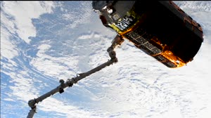
Expedition 63 HTV 9 Release
 Film