Opening the book…
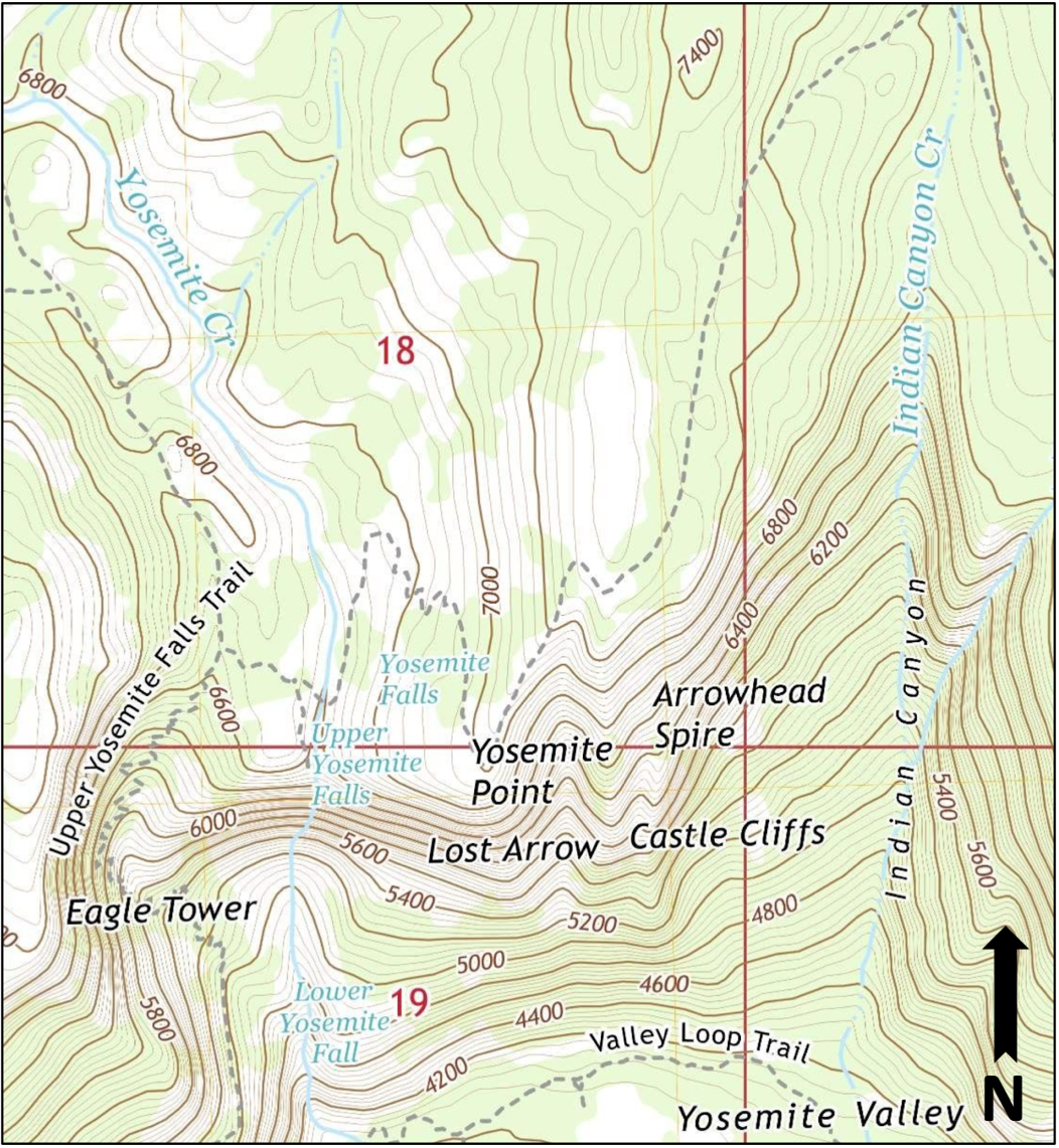
- Determine the contour interval of the map. Show your work.
- Locate Yosemite Creek. In which direction does Yosemite Creek flow?
- How were you able to determine the streamflow direction?
- In general, where are the steepest areas on this map?
- North
- South
- In general, where are the lower elevations on this map?
- North
- South
- If you wanted to take an easy hike with your family, would you select the Upper Yosemite Falls Trail or the Valley Loop Trail? Why would you make this choice?
Attributions
- Figure 2.23: Derivative of “Yosemite Falls Quadrangle 7.5-Minute Series (2018)” (Public Domain, USGS) by Chloe Branciforte
This page titled 2.4: Activity 2C- Reading a Topographic Map of Yosemite Valley was last modified on Fri, 06 May 2022 23:34:16 GMT and is shared under a CC BY-SA 4.0 license and was authored, remixed, and/or curated by Chloe Branciforte and Emily Haddad (ASCCC Open Educational Resources Initiative) .
The book could not be loaded just now.