Window mode follows your eyes with your camera, in this browser only: no picture or position leaves your device.
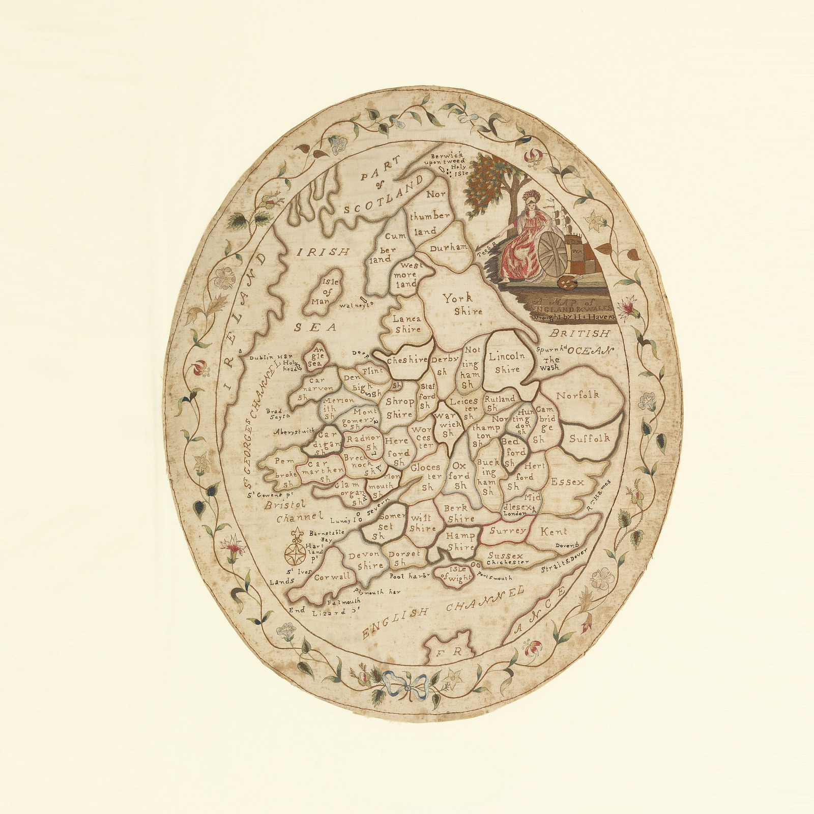
A Map of England and Wales
late 18th century
- Medium
- Medium: silk and linen embroidery on linen foundation Technique: embroidered in satin, stem and split stitches on plain weave Label: silk embroidered with silk in satin, stem and split stitches
- Classification
- Embroidery (visual works)
- Dimensions
- H x W: 55.9 × 46.7 cm (22 × 18 3/8 in.)
- Culture
- England
- Museum
- Smithsonian Institution, Cooper Hewitt, Smithsonian Design Museum
- Credit line
- Bequest of Mrs. Henry E. Coe
- Rights
- CC0 (Smithsonian Open Access), as the museum states it.
- Who can see it
- Little Ones profiles and older: it shows gentle subjects for the very young. How works are placed
View at the Smithsonian Institution
About this work
Oval map sampler of England and Wales, with the counties outlined and identified. With a portrait of Britannia in the upper right, and a flowering vine border.