Window mode follows your eyes with your camera, in this browser only: no picture or position leaves your device.
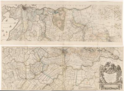
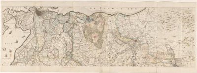
Kaart van de provincie Utrecht (onderste deel)
1696
- Medium
- paper, pencil, watercolor (paint)
- Classification
- map
- Dimensions
- height 660 mm x width 1856 mm
- Museum
- Rijksmuseum
- Rights
- Public Domain Mark, as the museum states it.
- Who can see it
- Teens profiles and older: its subject is for older viewers (war, death, the Passion, drink or the like). How works are placed
About this work
Onderste deel van een kaart van de provincie Utrecht. Zowel op de kaart als onder de plaatrand zijn verschillende handgeschreven aanvullingen aangebracht.