Window mode follows your eyes with your camera, in this browser only: no picture or position leaves your device.
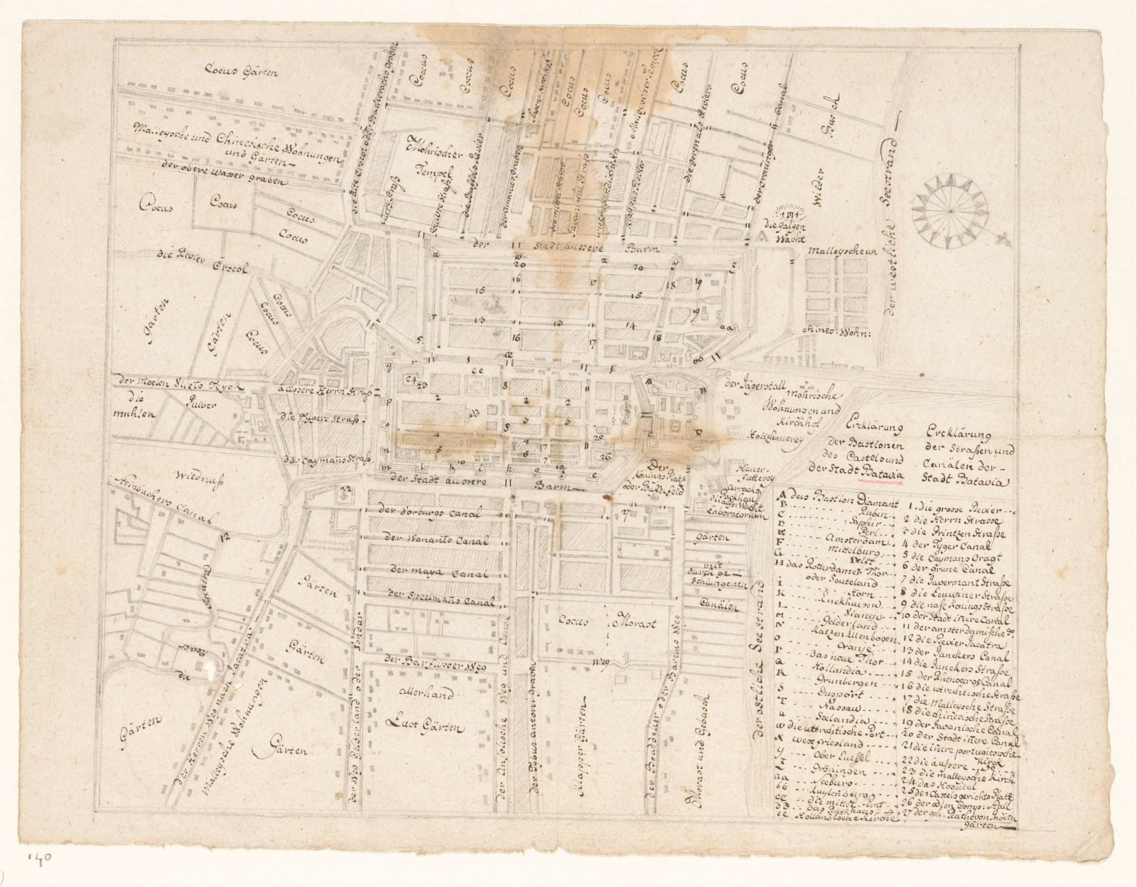
Plattegrond van Batavia
Jan Brandes (Bodegraven, 1743–1808)
1779 - 1785
- Medium
- paper, ink, pencil
- Classification
- drawing
- Dimensions
- height 240 mm x width 317 mm
- Museum
- Rijksmuseum
- Rights
- Public Domain Mark, as the museum states it.
- Who can see it
- Little Ones profiles and older: it shows gentle subjects for the very young. How works are placed
About this work
Stadsplan van Batavia met Duitse legenda. Naar een oude kaart van voor 1743-45 (afbraak kasteelmuur tussen Diamant en Robijn. Ook de lutherse kerk (voltooid 1749) staat er nog niet op. Brandes heeft deze met pen erbij getekend.