
Achter de schermen van het KNMI Weeknummer 74-07 - Open Beelden - 32229
Nederlands Instituut voor Beeld en Geluid
Low resolution (320×240): this is the archive's own copy. Where the browser can use the graphics chip, Enhance picture in the player's settings draws it sharper.
Make a clip
CC BY-SA 3.0 nl · Nederlands Instituut voor Beeld en Geluid
Up to 60 seconds, at most the picture size of the copy it is cut from. The clip carries the title, the credit, the licence and a link back here. It is made in this browser, and nothing is sent to this site.
Or send the moment itself: https://invisiblenetwork.ai/watch/archive/commons/12106939?play=1&t=0
Parts
About
Overview of the work of the KNMI. The high tower near Lopik where measurements are taken. Twice a day in De Bilt, measuring equipment and a radio transmitter with an embarrassed balloon measurements to 30km altitude to observe. Furthermore, the new building in De Bilt, where all data come together. The telex messages to other weather stations transmitted and received from them. The data and satellite images are processed into a weather map. The weather is recorded by a television camera and broadcast on television. Continue with a simulation of a weather satellite. With papers from industry, landing aircraft, road traffic in the fog and a tanker.
Human-made No record of this work says a model made it. What this means.
- Archive
- Wikimedia Commons, in Wikimedia Commons
- Licence or status
- CC BY-SA 3.0 nl, as the Wikimedia Commons states it.
- Rights statement
- Creative Commons Attribution-Share Alike 3.0 nl
- Credit
- Nederlands Instituut voor Beeld en Geluid
- Who can watch
- The archive gives no rating. Invisible Network shows it to Teens profiles and older, judged from its collection and subjects. How films are placed
More from Wikimedia Commons
 Short
Making a silver chain
 Short
Jennifer Doudna Nobel Prize medal presentation
 Short
¿Qué es Wikipedia?
 Short
Wie entstehen Fossilien (CC by 4.0)
 Short
Rudy Mancuso & Maia Mitchell - Magic (Official Music Video)
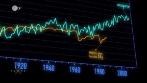 Documentary
Die wichtigsten Klimafaktoren (ZDF, Terra X) 720p 50FPS
 Short
Curiosity's Seven Minutes of Terror
 Short
Wikilovesmonuments.org
 Short
Wikipedia - FactsMatter2016
 Short
President Obama on Death of Osama bin Laden no watermark
 Short
Cassini's Grand Finale
 Cartoon