Opening the book…
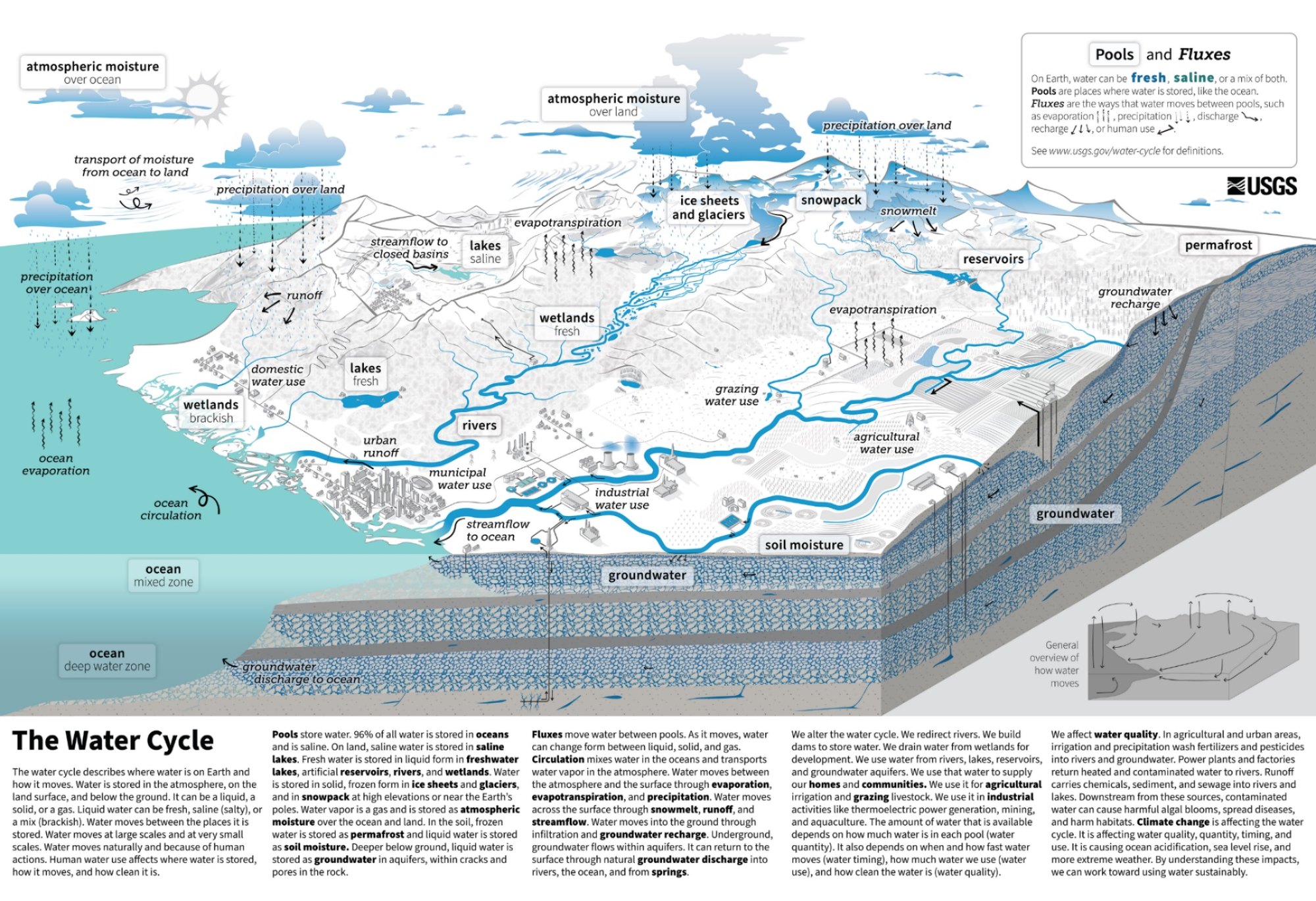
The hydrologic or water cycle describes how water circulates between these various reservoirs (pools) (Figure 6-10). Fluxes are how the water moves between the pools. Evaporation and transpiration transfer water to the air as vapor. This vapor condenses into clouds and precipitates back to the surface as rain, snow, sleet, or hail. Precipitation may directly return to the oceans or gather into surface waters that eventually drain back to the sea. Some water infiltrates the ground as groundwater. Global wind patterns and local topography determine where precipitation falls. For example, prevailing westerly winds bring moisture from the Pacific Ocean onshore in Seattle, resulting in abundant rainfall. The Cascade Mountains force clouds upward on their westward side, dropping rain, while leaving lands to the east in a drier "rain shadow."
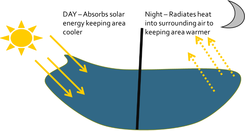
As water moves through the hydrologic cycle, it shapes Earth's environments and moderates Earth’s climate. The high specific heat capacity of water enables it to absorb energy without large changes in temperature. Bodies of water thus stabilize temperatures (Figure 6-9). During the day, light energy striking water. The energy is absorbed by the water with little change to the temperature. This heat-sink ability keeps the areas around these bodies of water slightly cooler than areas with the same solar input but without water. At night, the bodies of water radiate the heat in to surrounding air. This increases the atmospheric temperature adjacent to the waters. Thus, oceans and lakes act as heat reservoirs, warming air in winter and cooling it in summer.
This moderating effect decreases farther inland and way from the large bodies of water. This can be seen in more extreme temperature ranges in continental interiors like Wichita, Kansas compared to coastal cities like San Francisco (Figure 6-11). The prevailing winds at 37°N latitude blow from west to east. San Francisco’s temperature is moderated by the Pacific Ocean. Both Wichita and Norfolk are more heavily influenced by the continent.

Water's heat capacity also drives global circulation patterns by heating air masses over warm tropical oceans and cooling them over cold polar oceans. This creates major wind and precipitation belts around the planet. As the global winds drag across the ocean’s surface, currents develop. Five major ocean-wide currents (gyres) occur, North Atlantic, South Atlantic, North pacific, South pacific and Indian Ocean gyres (Figure 6-12). The North Atlantic gyre has a very strong western boundary current referred to as the Gulf Stream. The Gulf Stream originates in the Gulf of Mexico, exits through the Strait of Florida, and then follows the eastern coastline of the United States and Newfoundland. It travels at speeds of 25 to 75 miles per day at about 1.15-3.45 miles per hour. It influences the climate of the east coast of Florida, keeping temperatures warmer in the winter and cooler than the other southeastern states in the summer. It also influences severe weather patterns such as hurricanes.

1Ross, D. 1995 Introduction to Oceanography. New York: HarperCollins College Publishers. pp. 199-226, 339-343.
This page titled 6.2.1: The Water Cycle and Climate was last modified on Fri, 13 Nov 2026 17:55:31 GMT and is shared under a CC BY-NC-SA 4.0 license and was authored, remixed, and/or curated by Stephanie Harvey.
The book could not be loaded just now.