Window mode follows your eyes with your camera, in this browser only: no picture or position leaves your device.
Ganges Delta ESA22274217
23 October 2020 (upload date)
- Classification
- Photograph
- Museum
- Wikimedia Commons
- Credit line
- Ganges Delta
- Rights
- Attribution, as the museum states it.
- Who can see it
- Kids profiles and older: it shows nature, places, still life or a children's book. How works are placed
About this work
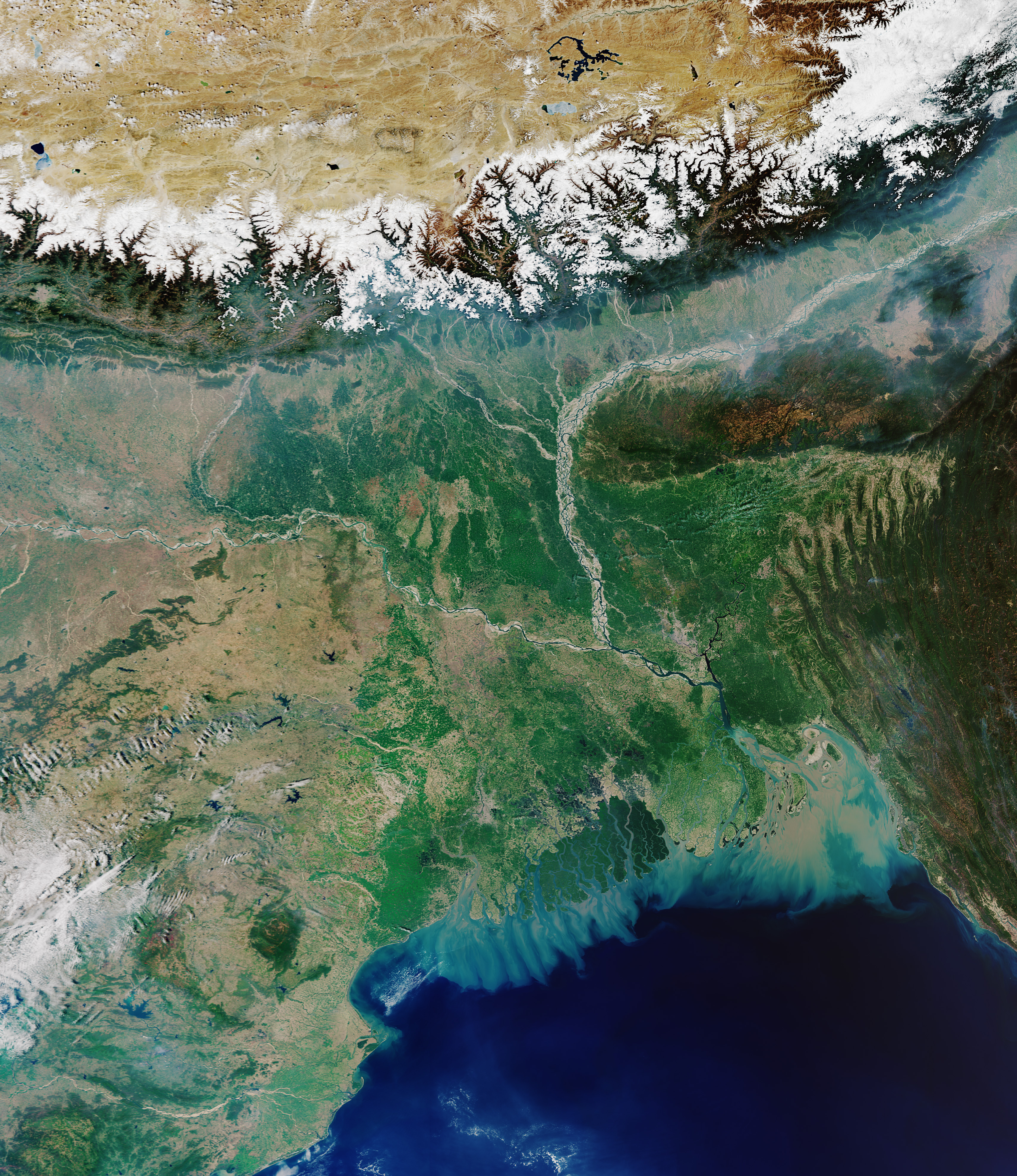
The Copernicus Sentinel-3 mission takes us over the Ganges Delta – the world’s largest river delta. Covering an area of around 100 000 sq km, the Ganges Delta lies in both Bangladesh and the State of West Bengal in India. The delta is formed mainly by the large, sediment-laden waters of the Ganges and Brahmaputra rivers. The river bed of the Ganges can be seen in the left of the image, while Brahmaputra can be seen to the right. The snow-covered Himalayas can be seen at the top of the image. The Ganges river carries fertile soil and nutrients, which it deposits across its vast delta floodplain. The river flows for over 2400 km from the Himalayas before emptying into the Bay of Bengal – the world’s largest bay. It is here where the murky coloured waters mix with the darker coloured waters of the Indian Ocean. The delta is largely covered with a swamp forest, known as the Sundarbans, and can be seen in dark green near the coast with several rivers snaking through it. The Sundarbans, which translates as 'beautiful forest' in Bengali, are the world’s largest mangrove forest and provide a critical habitat for numerous species, including the Bengal tiger and the Indian python. The city…