Window mode follows your eyes with your camera, in this browser only: no picture or position leaves your device.
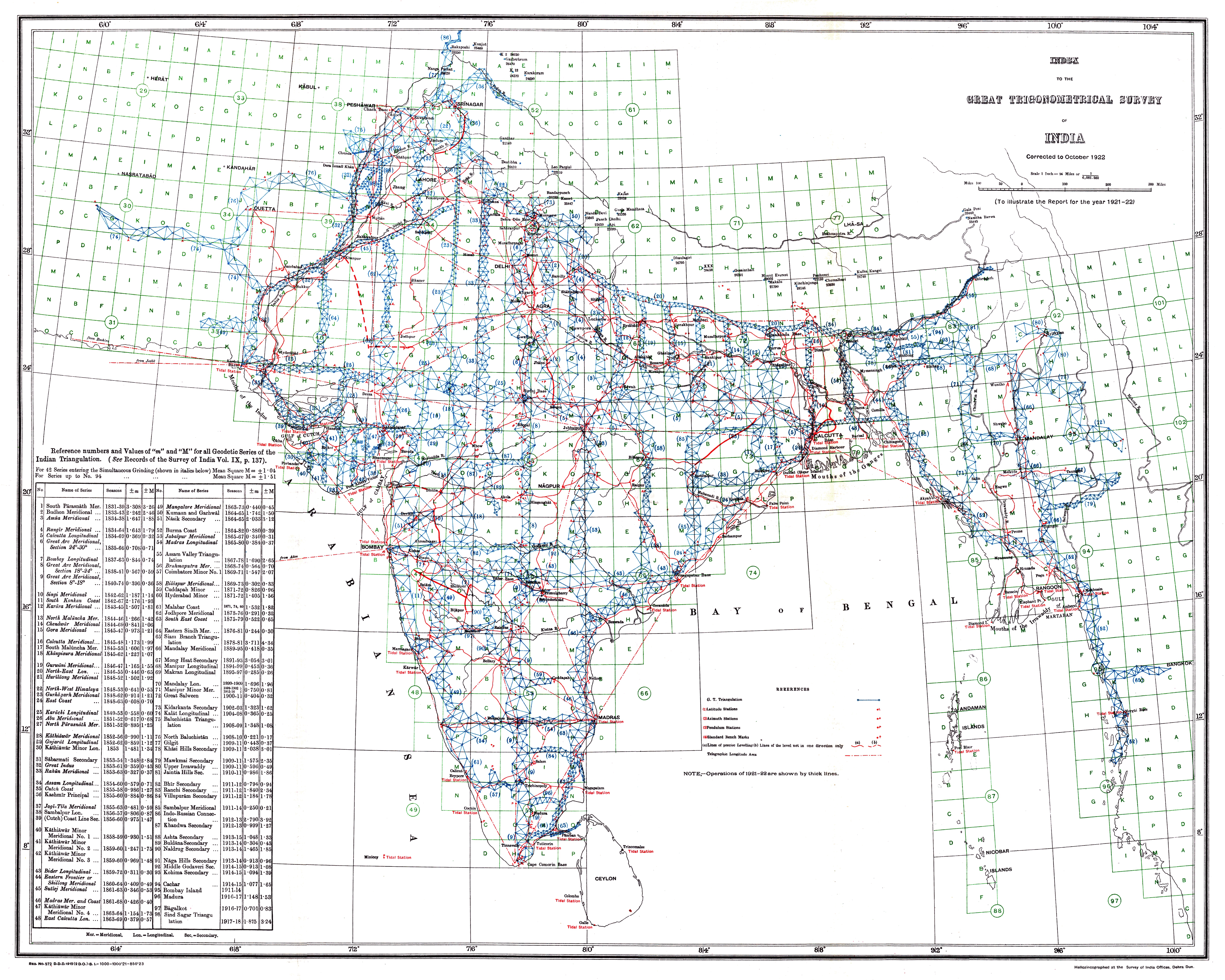
1922 Index of Great Trigonometrical Survey of India
Survey of India, Government of India
1922
- Classification
- Photograph
- Museum
- Wikimedia Commons
- Credit line
- Report of the Survey of India for 1921–22
- Rights
- Public domain, as the museum states it.
- Who can see it
- Teens profiles and older: its subject is for older viewers (war, death, the Passion, drink or the like). How works are placed
About this work
Index to the Great Trigonometrical Survey of India (1922). India is shown on a 1-degree grid of green lines. The blue triangles indicate the Great Trigonometrical w:triangulation measurements. Triangulation series are indicated by a number in parentheses. These series are described in the table at the bottom left. The red dash-dot lines are telegraph longitude area.
Among the many accomplishments of the Survey were the demarcation of the British territories in India and the measurement of the height of the Himalayan giants: Everest, K2, and Kanchenjunga.