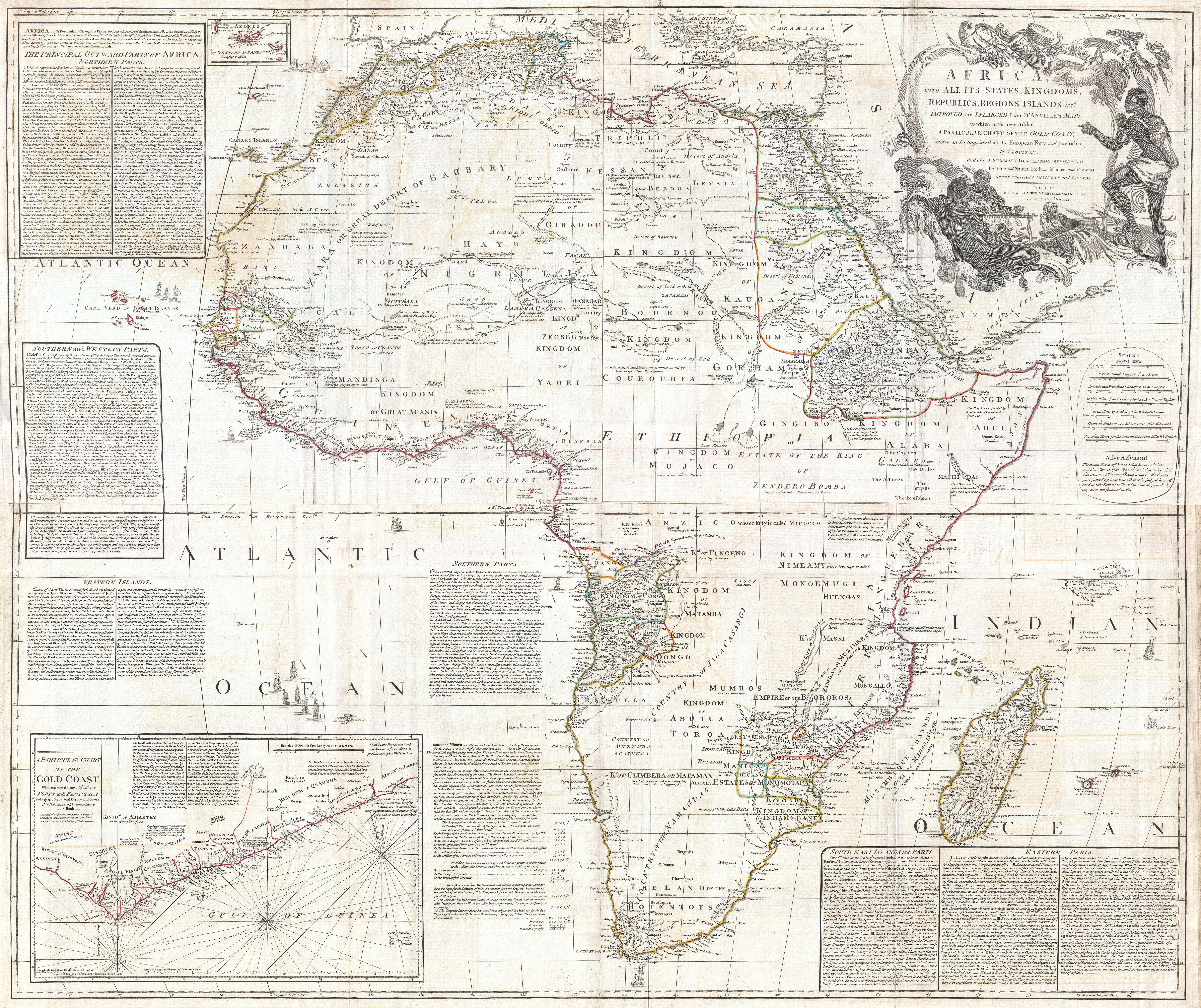
Africa, with all its States, Kingdoms, Republics, Regions, Islands, & cca. Improved and Inlarged from D’Anville’s Map: to which has been added A Particular Chart of the Gold Coast wherein are Distinguished all the European Forts, and…
Solomon Boulton / Jean Baptiste Bourguignon d'Anville
1794
- Classification
- Painting
- Museum
- Wikimedia Commons
- Credit line
- This file was provided to Wikimedia Commons by Geographicus Rare Antique Maps, a specialist dealer in rare maps and other cartography of the 15th, 16th, 17th, 18th and 19th centuries, as part of a cooperation project.
- Rights
- Public domain, as the museum states it.
- Who can see it
- Little Ones profiles and older: it shows gentle subjects for the very young. How works are placed
About this work
This is probably the most important map of Africa produced in the 18th century. Largely based upon the earlier D’Anville map, this map has been enlarged and expanded by Samuel Boulton. Depicts the continent in full with insets of the Gold Coast (or Ivory Coast, or Guinea). This map is unique in that it is a serious attempt to compile all of the accurate scientific knowledge of the African continent available at the time. In contrast to many other Africa maps of the period there's almost no attempt to fill the “unknown” regions of the interior with fictitious beasts, kingdoms, and geological features. Boulton himself advertises “The inland parts of Africa being but very little known and the names of the regions and countries which fill that vast tract of land being for the greatest part placed by conjecture it may be judged how absurd are the divisions traced in some maps and why they are not followed in this.“ Despite this, this map actually does provide a wealth of information both in the form of a gazetteer printed in framed text boxes here and there on the map, as well as political and geographical features.
This map bears up to almost endless perusal and volumes could be…