Window mode follows your eyes with your camera, in this browser only: no picture or position leaves your device.
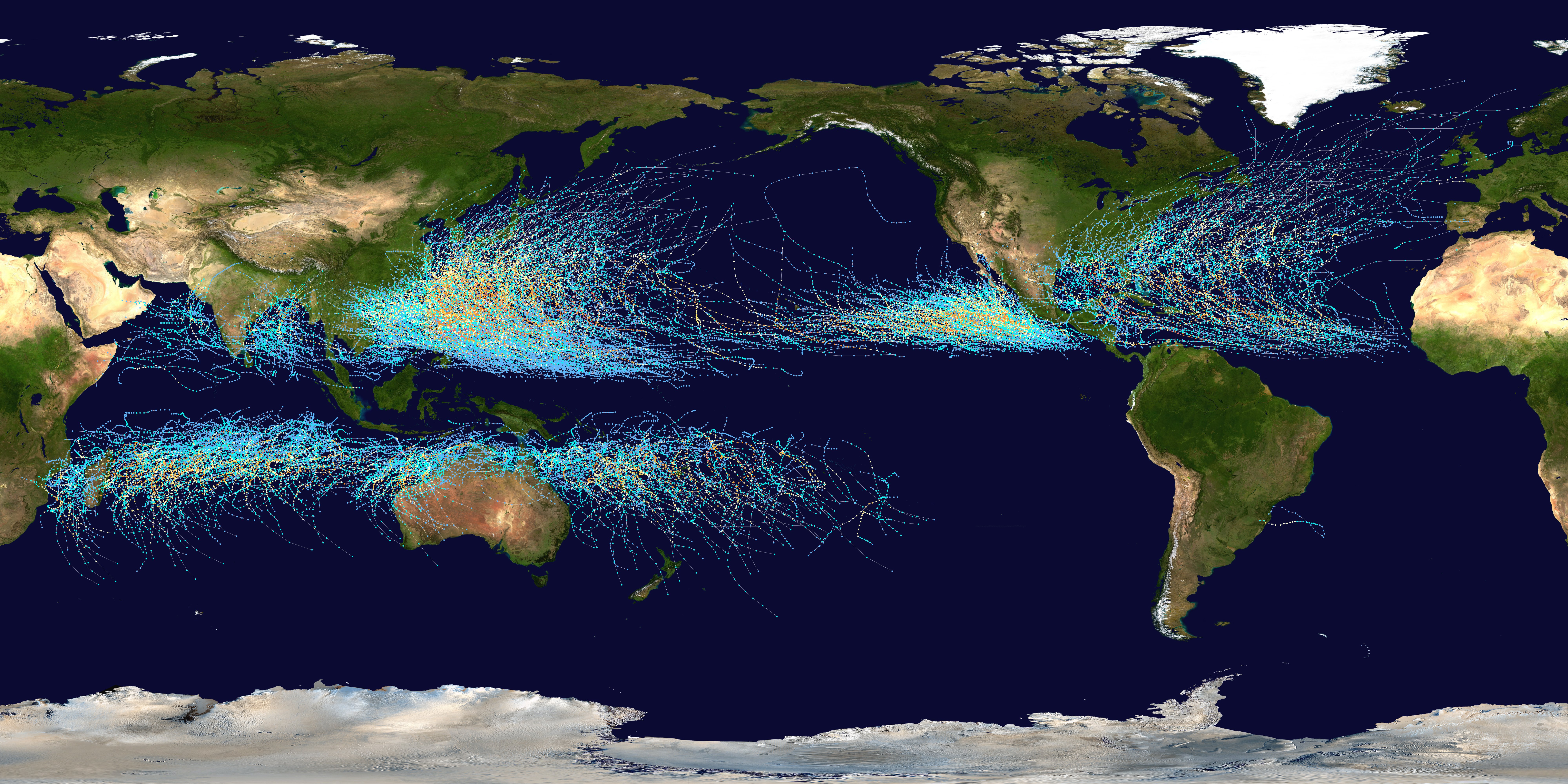
Global tropical cyclone tracks-edit2
2006-08-05
- Classification
- Photograph
- Museum
- Wikimedia Commons
- Credit line
- Created using User:jdorje/Tracks by Nilfanion on 2006-08-05. Background image from File:Whole_world_-_land_and_oceans.jpg (NASA). Tracking data for storms within the Atlantic and Eastern Pacific basins is taken from the National Hurricane…
- Rights
- Public domain, as the museum states it.
- Who can see it
- Kids profiles and older: it shows nature, places, still life or a children's book. How works are placed
About this work
This map shows the tracks of all Tropical cyclones which formed worldwide from 1985 to 2005. The points show the locations of the storms at six-hourly intervals and use the color scheme shown to the right from the Saffir-Simpson Hurricane Scale. However, remnants of the storms are not shown as triangles.