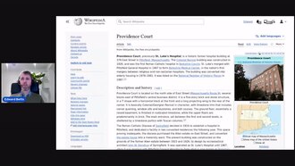
Tools for linking Wikidata and OpenStreetMap - Edward Betts
OpenStreetMap US
Make a clip
CC BY 3.0 · OpenStreetMap US
Up to 60 seconds, at most the picture size of the copy it is cut from. The clip carries the title, the credit, the licence and a link back here. It is made in this browser, and nothing is sent to this site.
Or send the moment itself: https://invisiblenetwork.ai/watch/archive/commons/127207694?play=1&t=0
Parts
About
I describe an editing tool for adding links from OpenStreetMap objects to the corresponding Wikidata items (https://osm.wikidata.link/). Mappers use the tool by searching for a place they are familiar with. The software downloads the details of Wikidata items within the bounds of the place and find matching objects in OpenStreetMap. The matcher compares places based on names, addresses and the type of object. The user is presented with a list of candidate matches, next to a map showing the matches. After the checks the matches are correct and then clicks a button to save the appropriate wikidata tags to OpenStreetMap. In the talk I will give details of a new version of the editing tool.
Human-made No record of this work says a model made it. What this means.
- Archive
- Wikimedia Commons, in Wikimedia Commons
- Licence or status
- CC BY 3.0, as the Wikimedia Commons states it.
- Rights statement
- Creative Commons Attribution 3.0
- Credit
- OpenStreetMap US
- Who can watch
- The archive gives no rating. Invisible Network shows it to Teens profiles and older, judged from its collection and subjects. How films are placed
More from Wikimedia Commons
 Short
¿Qué es Wikipedia?
 Short
Curiosity's Seven Minutes of Terror
 Short
Wikilovesmonuments.org
 Short
OYME - Tyushtya's song
 Short
Lift Every Voice and Sing - United States Navy Band
 Cartoon
Steamboat Willie (1928) by Walt Disney
 Short
Elephants Dream (2006)
 Feature
Night of the Living Dead (1968)
 Short
MandelbulbRot 00000-10501 VP9 slow lossless
 Feature
The Man Who Laughs (1928)
 Feature
PENDATANG (2023) full movie
 Documentary