Opening the book…
This section looks at verifying the accuracy of attributes. The verification process looks for both missing attributes and incorrect attribute values. Unlike geographic verification, there are no attribute verification procedures built within the software to verify their accuracy.
Instead, the layer’s data file can be displayed and sorted by each attribute in ascending order to identify missing attributes (see Figure 4.12). Map features missing a value for a particular field are revealed at the top of the table. Selecting those features from the data file and highlighting them on the screen can be a handy way to reference those features that have missing attributes. The selected features can then be investigated and updated. You can also sort the attributes alphabetically and glance down the field looking for spelling mistakes.
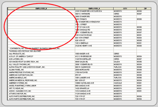
Figure 4.12: Sorting in ascending order can reveal missing data.
More difficult to detect are incorrect attribute values. They require familiarity with the original source maps and an understanding of spatial patterns. For example, if you were working with income data, you should select low income values and display them on a map. Does their spatial location make sense? Do the same with high income values. Nominal data sets can be displayed the same way. For example, select different land use classes, and see if they make geographic sense. Display all heavy industrial sites and look at their locations. If heavy industry appears in the middle of wealthy residential areas or they are not located along highways, railroads, or rivers (which they need for transportation purposes) than these values may be inaccurate. More information may be needed; try looking at web-based aerial photographs or field check odd values.
This page titled 4.6: Attribute Verification was last modified on Sat, 20 Sep 2025 23:50:38 GMT and is shared under a CC BY-SA 3.0 license and was authored, remixed, and/or curated by Michael Schmandt via source content that was edited to the style and standards of the LibreTexts platform.
The book could not be loaded just now.