Opening the book…
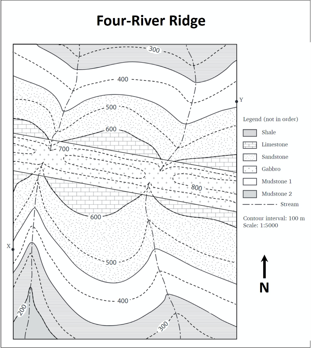
- Examine the map of the Four-River Ridge. Refer to the map legend. What kind of rocks are found in this map area (circle all that apply)?
- Sedimentary
- Igneous
- Metamorphic
- How many units can you see?
- Carefully study the relationship between the contour lines and the contact between the limestone and sandstone. What does this tell you about the orientation of these beds?
- Examine the gabbro unit. What V pattern is formed by the four rivers that cut through this unit? What does this tell you about the orientation of this unit?
- What is the strike and dip of the sedimentary units in this map area?
- Strike direction:
- Dip direction:
- What is the strike and dip of the gabbro dyke?
- Strike direction:
- Dip direction:
- Draw a geological cross-section between the points X and Y indicated on this map. Note: you will have to prepare a cross-section from scratch for this exercise, but you can use the format from the Murky Mists cross-section as a guide.
- Describe the geological history of the map area, a bulleted list is OK to use here. Hint: start with the oldest event and describe events as they occurred up to the present day.
Attributions
- Figure 16.16: Derivative of “Four-River Ridge” (CC-BY 4.0; Karla Panchuk via OpenPress) by Chloe Branciforte
This page titled 16.7: Activity 16F- Four-River Ridge Geologic Map was last modified on Mon, 05 Jul 2021 19:19:55 GMT and is shared under a not declared license and was authored, remixed, and/or curated by Chloe Branciforte and Emily Haddad (ASCCC Open Educational Resources Initiative) .
The book could not be loaded just now.