Window mode follows your eyes with your camera, in this browser only: no picture or position leaves your device.
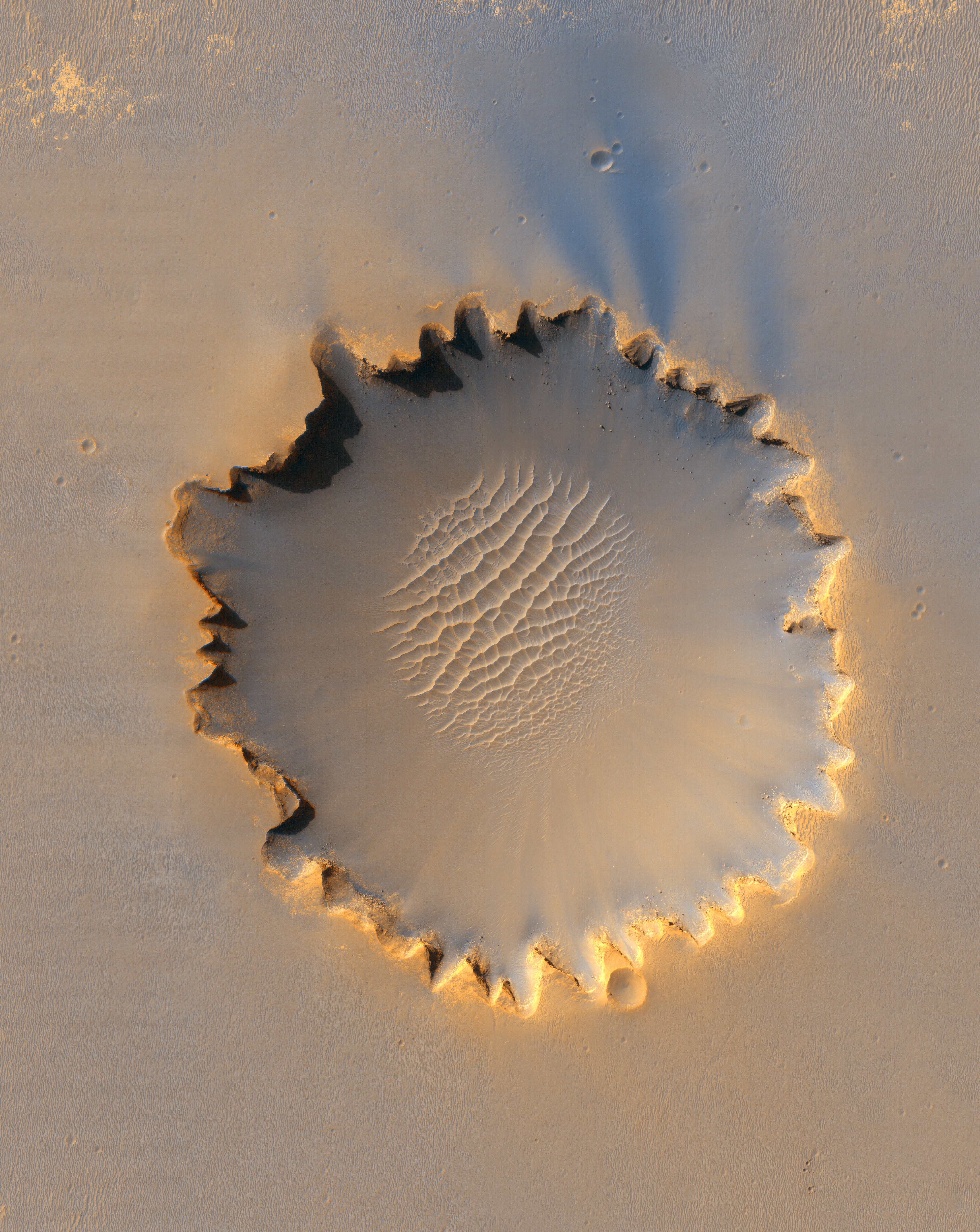
Victoria crater from HiRise
NASA/JPL/University of Arizona
2006-10-03
- Classification
- Photograph
- Museum
- Wikimedia Commons
- Credit line
- http://photojournal.jpl.nasa.gov/catalog/PIA08813
- Rights
- Public domain, as the museum states it.
- Who can see it
- Teens profiles and older: its museum says too little about what it shows to place it for younger viewers. How works are placed
About this work
This image from the High Resolution Imaging Science Experiment on NASA's Mars Reconnaissance Orbiter shows "Victoria crater," an impact crater at Meridiani Planum, near the equator of Mars. The crater is approximately 800 meters (half a mile) in diameter. It has a distinctive scalloped shape to its rim, caused by erosion and downhill movement of crater wall material. Layered sedimentary rocks are exposed along the inner wall of the crater, and boulders that have fallen from the crater wall are visible on the crater floor. The floor of the crater is occupied by a striking field of sand dunes.
Since January 2004, the Mars Exploration Rover Opportunity has been operating at Meridiani Planum. Five days before this image was taken, Opportunity arrived at the rim of Victoria crater, after a drive of more than 9 kilometers (over 5 miles). The rover can be seen in this image, at roughly the "ten o'clock" position along the rim of the crater.
This view is a portion of an image taken by the High Resolution Imaging Science Experiment (HiRISE) camera onboard the Mars Reconnaissance Orbiter spacecraft on Oct. 3, 2006. The complete image is centered at minus7.8 degrees latitude, 279.5…