Window mode follows your eyes with your camera, in this browser only: no picture or position leaves your device.
Hawaje-NoRedLine
2003-05-27
- Classification
- Photograph
- Museum
- Wikimedia Commons
- Credit line
- File:Hawaje.jpg Original source: NASA. Image courtesy Jacques Descloitres, MODIS Land Rapid Response Team at NASA GSFC. (IotD Date: 2003-06-03. IotD ID: 15304)
- Rights
- Public domain, as the museum states it.
- Who can see it
- Kids profiles and older: it shows nature, places, still life or a children's book. How works are placed
About this work
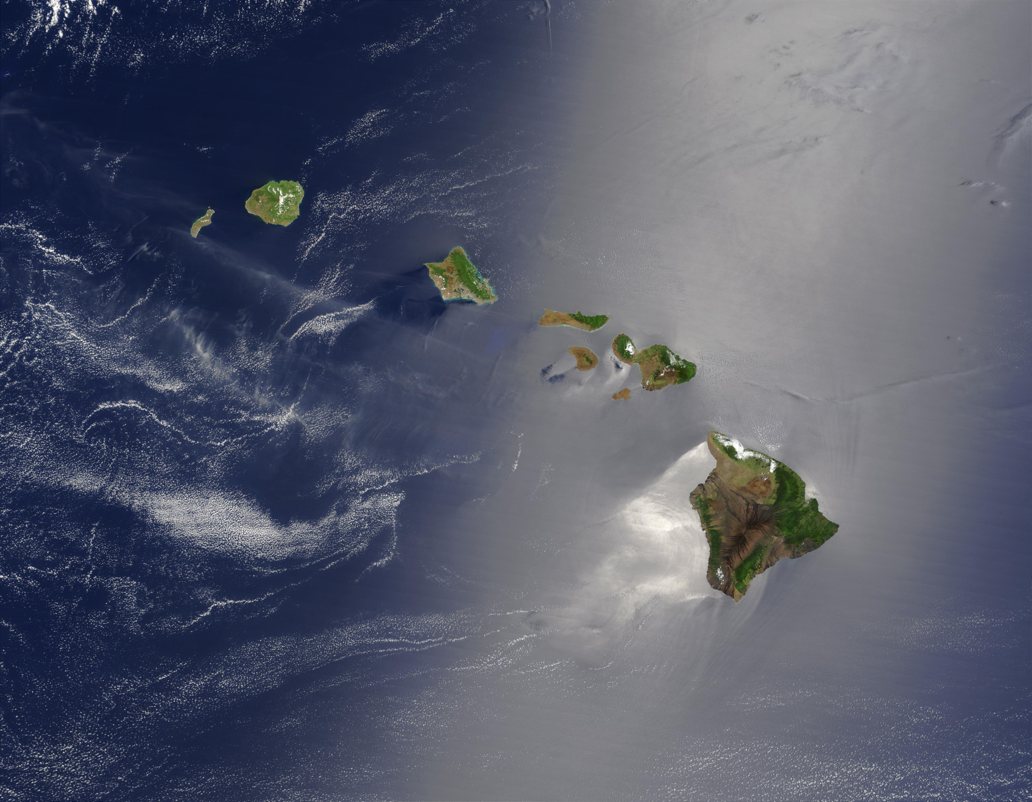
Satellite view of Hawaii archipelago (USA) Original description from NASA:
"A silver swath of sunglint surrounds half of the Hawaiian islands in this true-color Terra MODIS image acquired on May 27, 2003. Sunglint reveals turbulence in the surface waters of the Pacific Ocean. If the surface of the water was as smooth as a perfect mirror, we would see the circle of the Sun as a perfect reflection. But because the surface of the water is ruffled with waves, each wave acts like a mirror and the Sun’s reflection gets softened into a broader silver swath, called the sunglint region.
"In this scene, the winds ruffling the water surface around the Hawaiian Islands create varying patterns, leaving some areas calmer than others. Southwest of Hawaii and Maui, on their leeward sides, calmer waters are indicated by brighter silver coloration. Conversely, notice how most of the vegetation on the Hawaiian Islands grows on their northeastern, or windward, sides.
"From lower right to upper left, the “Big Island” (Hawaii), Maui, Kahoolawe, Lanai, Molokai, Oahu, Kauai, and Niihau islands all make up the state of Hawaii, which lies more than 2,000 miles from any other part of the United States."